|
EXERCISE
2
Objectives
When you have finished this exercise you will be able to:
Data
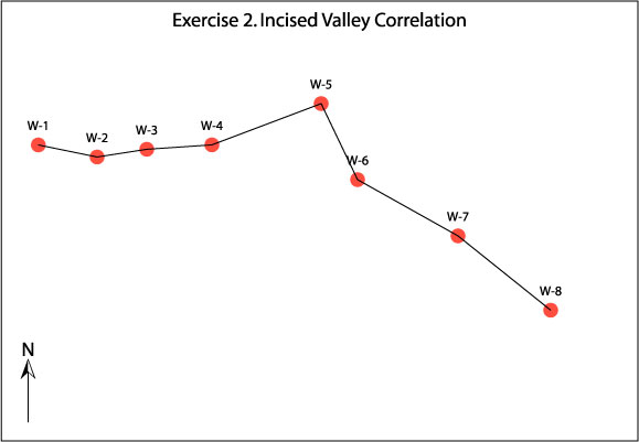
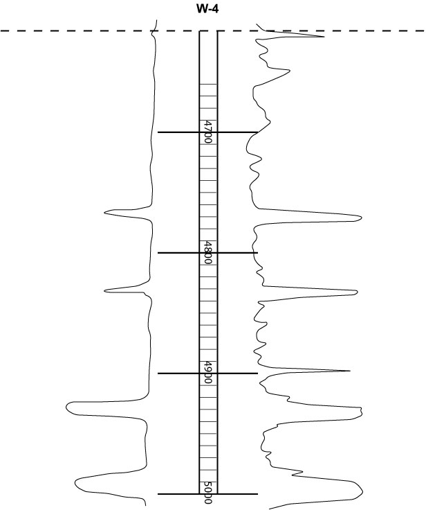
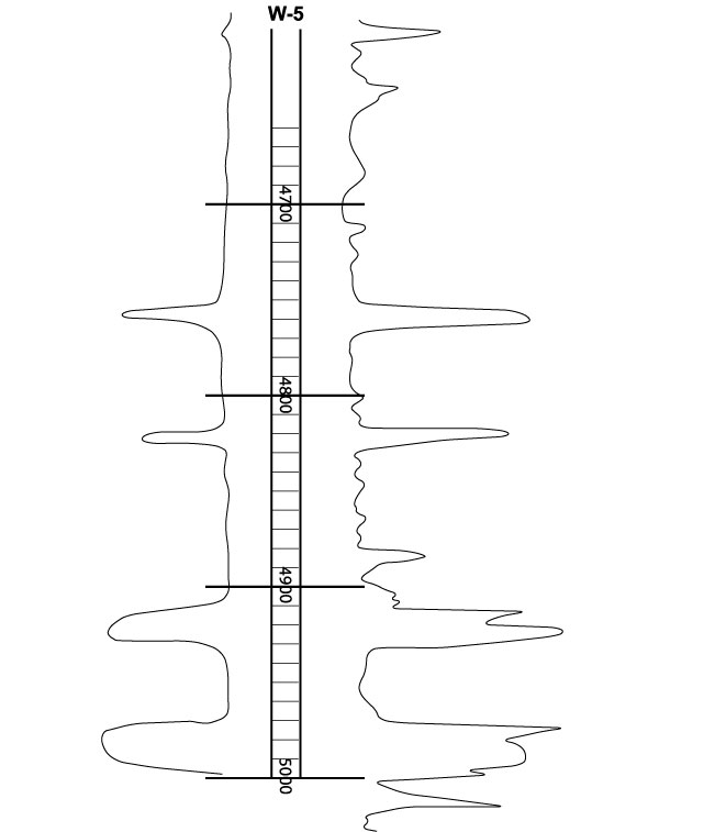
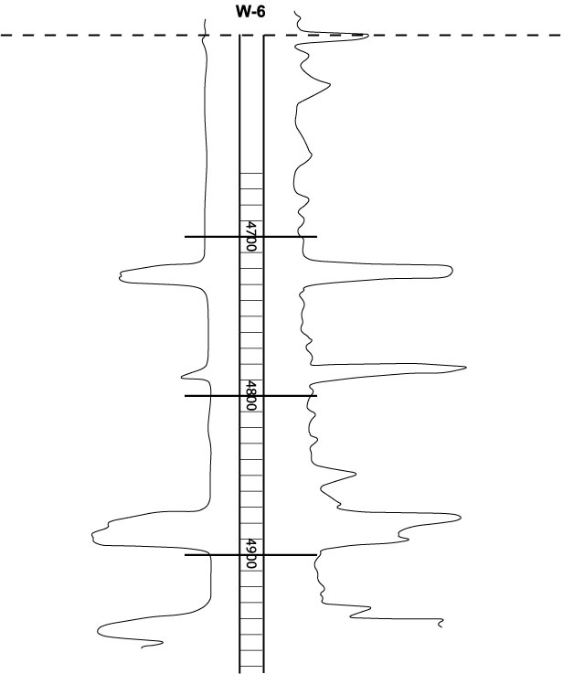
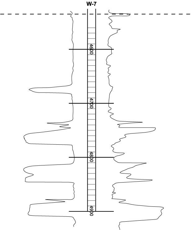
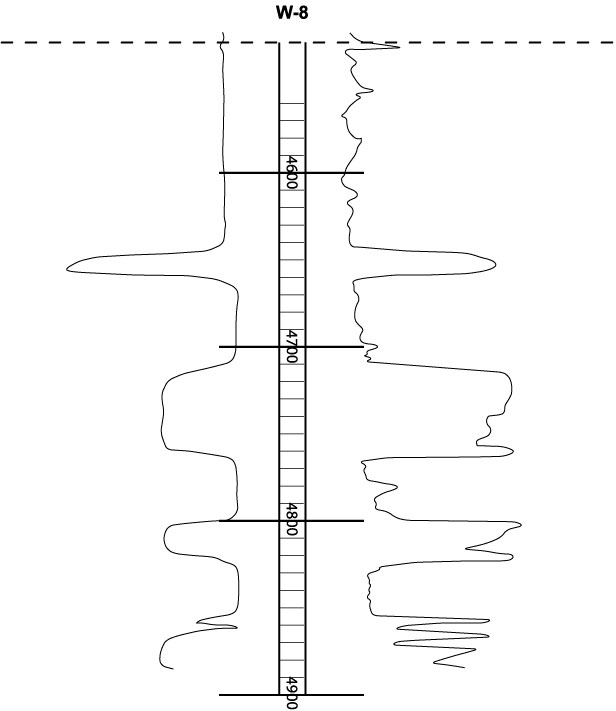
You are provided with a basemap which
locates 8 wells (W-1, W-2
, W-3, W-4, W-5,
W-6, W-7, W-8)
that can be correlated using Spontaneous
Potential and Resistivity
logs. A pdf file containing all wells and a basemap can printed
and taped (PRINTABLE-EX-2).
A reduced pdf file version can be also viewed/and or printed (VIEW-EX-2).
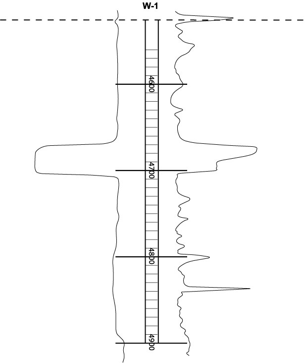
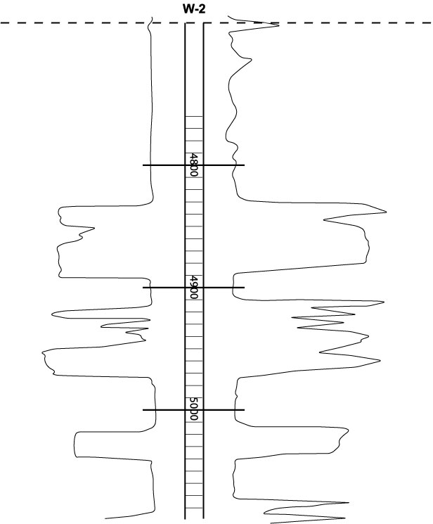
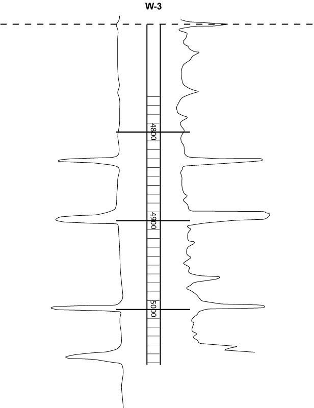
These well logs are flattened on the top of a major transgressive
surface (TS) on the silt marking the contact between the La
Pascua below and the overlying Roblecito Formation.
Methods
Utilize the Gulf
Coast slip-slide method to help you match the log
sections and identify the same geologic events on the various wells.
- Color
sands yellow
and shales green.
- Correlate
using the upper common (dashed) marker as your basic datum.
- For each
parasequence identify the TSs
(transgressive surfaces) and then correlate these on all the
well logs provided. These transgressive correlation surfaces used
in all the sets of exercises extend across the area penetrated
by the wells, except where they are interrupted by the incision
of local channels. These surfaces cap silty horizons that are
equated with surfaces of
transgression (TS) that formed at wave base, and above, when
the sea floor was reworked just following a sea level low (view
the movie to understand this).
- Click on the thumbnail
below to view the movie that demonstrates the technique that first
uses the transgressive surfaces to build a framework of parasequences
from these correlated surfaces and then infills the other surfaces
between these as outlined below!

Don't forget to use the left and right
keyboard arrows to control the forward and backward motion
of the movie so you can review this as you view it!
- Normally
radioactive peaks on Gamma
Ray Logs, associated with mfs,
are more extensive and would have been better correlation surfaces
than the Transgressive surfaces but Gamma Ray Logs were not available
for much of the Guarico Sub Basin. As in the movie above you should
use geologic logic to infer the location of the Maximum Flooding
Surface (mfs) and correlate these on all the well logs.
- Thus
as shown in the film make a cross-section first correlating the
prominent silts for all the wells and then correlating the sands.
- Pick
base of massive sands and correlate these from well to well when
they occur on other logs in other wells.
- Identify
the sequence boundaries (SB)
at base of the massive sands and correlate these from well to
well.
- Identify
all system tracts, including the incised valley, on all well logs.
- For each parasequence
(bounded by mfs's) estimate and record the net sand (in feet).
- Utilize
the spread sheet provided and net sands to contour
the combined data. You should be able to establish the orientation
of the regional trends in the depositional systems you identify.
- Click on
the thumbnial below to view the movie that tracks an interpretation
of the character of the sedimentary fill of the Guarico Basin
during the deposition of the La Pascua Formation.

Don't forget to use the left and right keyboard
arrows to control the forward and backward motion of the movie
so you can review this as you view it!
To help with your interpretation of the well logs you should both
view the above movies and read the earlier sections related to the
geologic setting of the La Pascua Formation
and the introduction
to the sequence stratigraphy of the La Pascua Formation. From these you
will know something of the depositional setting of these rocks.
You should combine the techniques outlined above with this understanding
of the regional geology and your understanding of vertical and lateral
facies relationships in near shore clastic settings (eg. shoreline,
beach,
stacked
beaches, tidal
flats,
deltas) and Walther's
Law. You should use these to build a depositional model and
a sequence stratigraphic interpretation of the well log section.
|
