Introduction
Libya occupies an area of some 1.8 million sq. kms with a 1800 km shoreline along the southern margin of the Mediterranean Sea. The country is the repository of some 50 billion barrels of in place oil reserves entrapped in Paleozoic, Mesozoic and Tertiary sediments. Structurally Libya is part of the Mediterranean foreland formed by the North African shield, and has a sedimentary section that has been subjected to transgressions and regressions since the early Paleozoic. The result is a mix of sheets of non-marine sediments (shale and sandstone) and other shallow marine carbonates that have been deposited all over platforms formed in local Cratonic basins.
The collision of the African and European plates caused a N-S directed compressional stress field in the northern portion of the African continent (Wennekers, et al., 1996). The main tectonic events that shaped the structure of Libya (Figure 13) are a compressional early Paleozoic Pan-African event, the Hercynian, and extension related to Cretaceous, middle Tertiary and Holocene events. The structure of southern Libya was influenced by the Pan-African event, whereas the central part of Libya was much affected by the Hercynian tectonic events. On the other hand the structures of north Libya are attributed to the Tethyan extension and Alpine tectonic movements (Goudarzi, 1980). The opening of the Mediterranean began in Early Jurassic with E-W axis direction, but by the Early Cretaceous the Mediterranean sea floor spreading had ceased entirely.
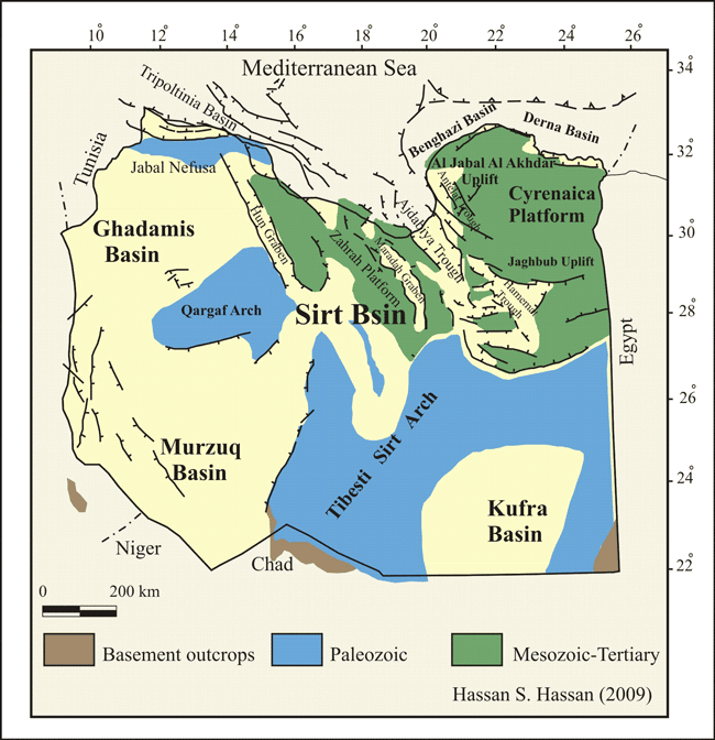
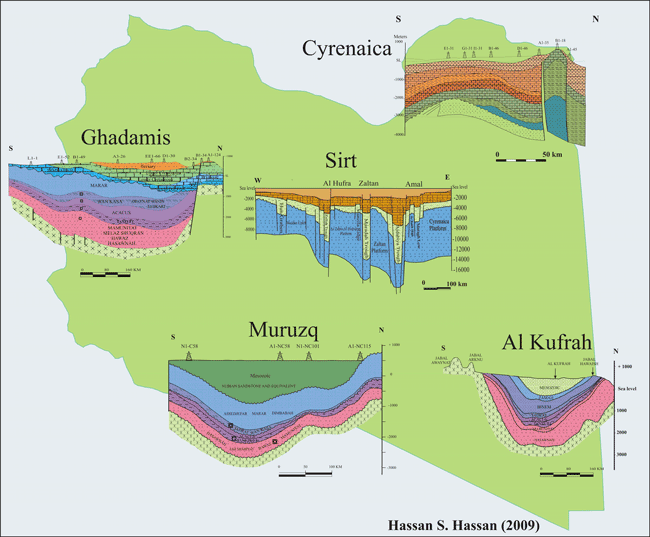
Major tectonic elements of Libya. (Modified after Rusk 2002)Libya has five major sedimentary basins which are; the Sirt Basin, Murzaq Basin, Kufra Basin, Ghadamis Basin and Cyrenaican Platform (Fig. 14 ). Epirogenic movement that were vertical nature are limited to uparching and faulting that occurred in northern Libya. These were responsible for the large sedimentary sequences in Libyan basins included the Mesozoic-Tertiary basins of Sirt and Cyrenaica. The generation and entrapment of hydrocarbon in Libya was controlled by the tectonic history of each individual basin. Libya includes several hydrocarbon provinces of which the most important is Sirt Basin (Fig. 16).
Sedimentary basins of Libya
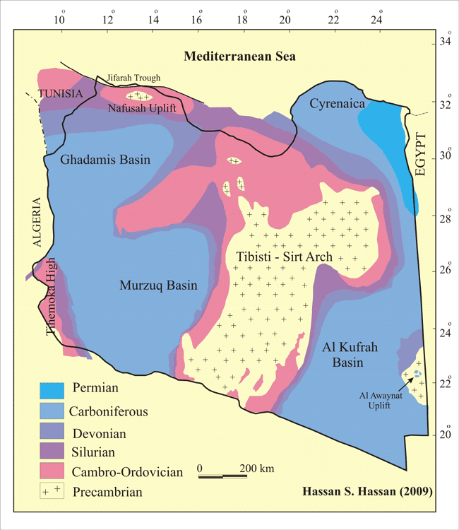
Pre-Mesozoic subcrop map, showing the post-Hercynian deformation before Mesozoic sedimentation took place (after Boote et al., 1998, Hallett and Ghoul, 1996, El Arnauti and Shelmani, 1985)
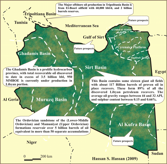
basins of Libya with potential for production.